Data Journalism Data Journalism Top 10
Data Journalism Top 10: Turkey-Syria Earthquake, Russian Censorship, Missing Snow, Energy Saving Tips
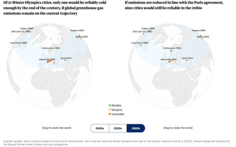
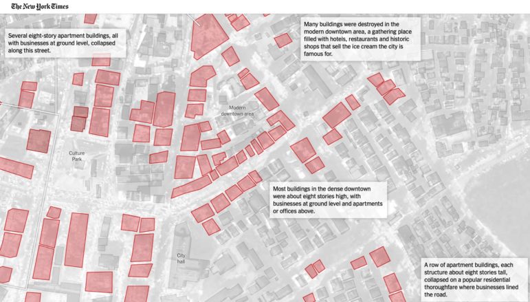
Our weekly round-up of the most popular data journalism stories on Twitter looks at mapping of the destruction in the Turkey-Syria earthquake, insight into Russia’s digital censorship apparatus, an alarming lack of snow on Swiss ski slopes, and a tool to help you save energy.