Editor’s Note: This article was originally published by The Conversation and is reposted here under a Creative Commons license.
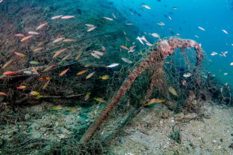
Image: Shutterstock
Using AI and Satellites to Track Illegal Fishing in Marine Protected Areas
Marine protected areas cover more than 8% of the world’s oceans today, but they can get a bad rap as being protected on paper only.
While the name invokes safe havens for fish, whales and other sea life, these areas can be hard to monitor. High-profile violations, such as recent fishing fleet incursions near the Galapagos Islands and ships that “go dark” by turning off their tracking devices, have fueled concerns about just how much poaching is going undetected.
But some protected areas are successfully keeping illegal fishing out.
In a new global study using satellite technology that can track large ships even if they turn off their tracking systems, my colleagues and I found that marine protected areas where industrial fishing is fully banned are largely succeeding at preventing poaching.
What Marine Protected Areas Aim to Save
Picture a sea turtle gliding by as striped butterfly fish weave through coral branches. Or the deep blue of the open ocean, where tuna flash like silver and seabirds wheel overhead.
These habitats, where fish and other marine life breed and feed, are the treasures that marine protected areas aim to protect.
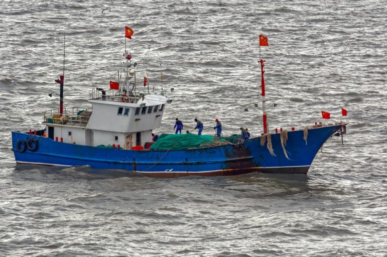
These vessels can operate worldwide and stay at sea for years at a time with visits from refrigerated cargo ships that ferry their catch to port. China has an extensive global fleet of ships that operate as far away as the coast of South America and other regions.
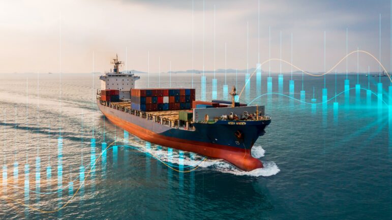
The global industrial fishing fleet — nearly half a million vessels — hauls in about 100 million metric tons of seafood each year. That’s about a fivefold increase since 1950, though it has been close to flat for the past 30 years. Today, more than one-third of commercial fish species are overfished, exceeding what population growth can replenish.
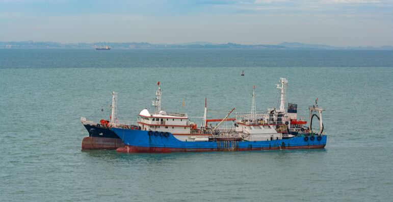
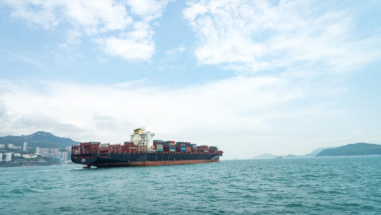
Modern fishing vessels can stay at sea for months at a time and often offload their catch to processing vessels, making enforcement of marine protected areas difficult. Image: Shutterstock
When well-designed and enforced, marine protected areas can help restore fish populations and marine habitats. My previous work shows they can even benefit nearby fisheries because the fish spill over into surrounding areas.
That’s why expanding marine protected areas is a cornerstone of international conservation policy. Nearly every country has pledged to protect 30% of the ocean by 2030.
Big Promises — and Big Doubts
But what “protection” means can vary.
Some marine protected areas ban industrial fishing. These are the gold standard for conservation, and research shows they can be effective ways to increase the amount of sea life and diversity of species.
However, most marine protected areas don’t meet that standard. While governments report that more than 8% of the global ocean is protected, only about 3% is actually covered by industrial fishing bans. Many “protected” areas even allow bottom trawling, one of the most destructive fishing practices, although regulations are slowly changing.
The plentiful fish in better-protected areas can also attract poachers. In one high-profile case, a Chinese vessel was caught inside the Galápagos Marine Reserve with 300 tons of marine life, including 6,000 dead sharks, in 2017. This crew faced heavy fines and prison time. But how many others go unseen?
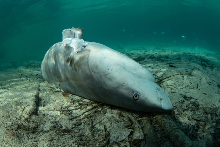
A dead Indonesian bull shark that has had its fins removed for the soup trade. Image: Shutterstock
Shining a Light on the ‘Dark Fleet’
Much of what the world knows about global industrial fishing comes from the automatic identification system, or AIS, which many ships are required to use. This system broadcasts their location every few seconds, primarily to reduce the risk of collisions at sea. Using artificial intelligence, researchers can analyze movement patterns in these messages to estimate when and where fishing is happening.
But AIS has blind spots. Captains can turn it off, tamper with data or avoid using it entirely. Coverage is also spotty in busy areas, such as Southeast Asia.
New satellite technologies are helping to see into those blind spots. Synthetic aperture radar can detect vessels even when they’re not transmitting AIS. It works by sending radar pulses to the ocean surface and measuring what bounces back. Paired with artificial intelligence, it reveals previously invisible activity.
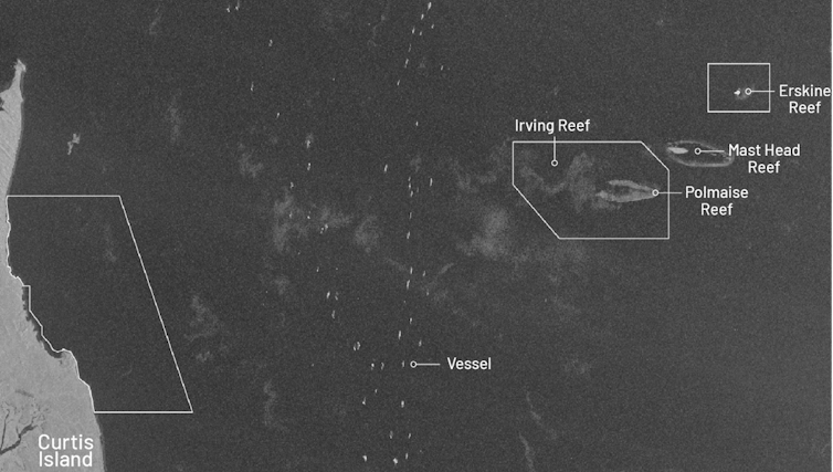
This composite image using synthetic aperture radar data from 2017 to 2021 shows ship activity over those years in a small section of the Great Barrier Reef Marine Park in Australia, outlined in white. It is a kind of time-lapse image that reveals vessel activity. Image: Courtesy of Jennifer Raynor, Sara Orofino, and Gavin McDonald
Synthetic aperture radar still has limits — primarily difficulty detecting small boats and less frequent coverage than AIS — but it’s still a leap forward. In one study of coastal areas using both technologies, we found in about 75% of instances fishing vessels detected by synthetic aperture radar were not being tracked by AIS.
New Global Analysis Shows What Really Happens
Two studies published in the journal Science on July 24, 2025, use these satellite datasets to track industrial fishing activity in marine protected areas.
Our study looked just at those marine protected areas where all industrial fishing is explicitly banned by law.
We combined AIS vessel tracking, synthetic aperture radar satellite imagery, official marine protected area rules, and implementation dates showing exactly when those bans took effect. The analysis covers nearly 1,400 marine protected areas spanning about 3 million square miles (7.9 million square kilometers) where industrial fishing is explicitly prohibited.
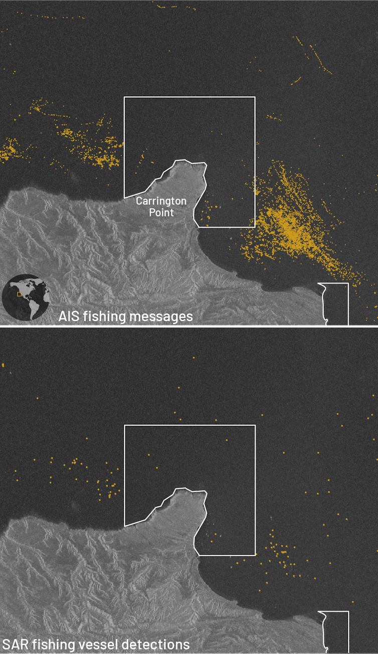
AIS transponder signals over 2017-2021 (top) and synthetic aperture radar data (bottom) both show industrial fishing activity (yellow) mostly avoiding Carrington Point State Marine Reserve, a protected area off California’s Santa Rosa Island. Images: Courtesy of Jennifer Raynor, Sara Orofino, and Gavin McDonald
The results were striking:
- Most of these protected areas showed little to no signs of industrial fishing.
- We detected about five fishing vessels per 100,000 square kilometers (38,610 square miles) on average in these areas, compared to 42 on average in unprotected coastal areas.
- 96% had less than one day per year of alleged illegal fishing effort.
The second study uses the same AIS and synthetic aperture radar data to examine a broader set of marine protected areas — including many that explicitly allow fishing. They document substantial fishing activity in these areas, with about eight times more detections than in the protected areas that ban industrial fishing.
Combined, these two studies lead to a clear conclusion: Marine protected areas with weak regulations see substantial industrial fishing, but where bans are in place, they’re largely respected.
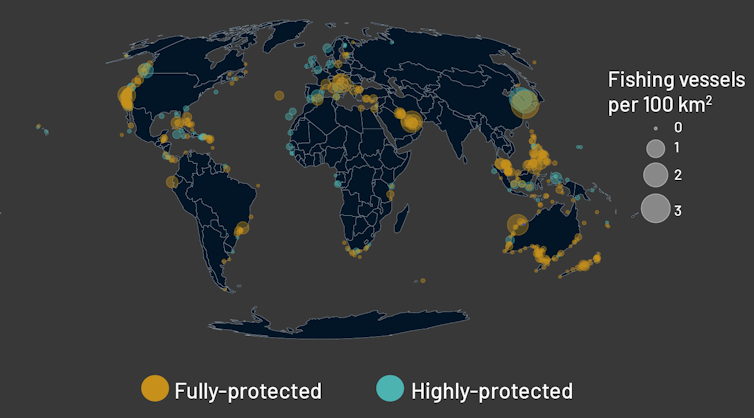
A map of global industrial fishing activity shows few vessels per 100,000 square kilometers in most fully protected and highly protected areas. The average is about nine times lower than what’s found in unprotected coastal areas. Image: Courtesy of Jennifer Raynor, Sara Orofino, and Gavin McDonald
Reason for Optimism
These technological advances in vessel tracking have the potential to reshape marine law enforcement by significantly reducing the costs of monitoring.
Agencies such as national navies and coast guards no longer need to rely solely on costly physical patrols over huge areas. With tools such as the Global Fishing Watch map, which makes vessel tracking data freely available to the public, they can monitor activity remotely and focus patrol efforts where they’re needed most.
That can also have a deterrent effect. In Costa Rica’s Cocos Island National Park, evidence of illegal fishing activity decreased substantially after the rollout of satellite and radar-based vessel tracking. Similar efforts are strengthening enforcement in the Galapagos Islands and Mexico’s Revillagigedo National Park.
Beyond marine protected areas, these technologies also have the potential to support tracking a broad range of human activities, such as oil slicks and deep-sea mining, making companies more accountable in how they use the ocean.
 Jennifer Raynor is an assistant professor of natural resource economics at the University of Wisconsin-Madison. Before entering academia, she conducted policy-relevant economic research for the US federal government for nearly a decade, most recently at National Oceanic and Atmospheric Administration Fisheries. Raynor serves on the Board of Trustees for Global Fishing Watch, and her research has appeared in top journals such as Science and The Proceedings of the National Academy of Sciences. Her work has also been featured in major national and international news outlets, such as The Atlantic, The Associated Press, The Washington Post, The Economist, National Geographic, Scientific American, and Smithsonian Magazine.
![]()

The Oceans Investigations Guide
Tracking Ships at Sea

GIJN Webinar: How to Acquire Free Satellite Imagery for Your Investigations

GIJC23 – Plane and Ship Tracking

Toolkit: How to Investigate Illegal, Unreported, and Unregulated (IUU) Fishing
How an Award-Winning, Cross-Border Project Investigated on the Open Ocean
Tipsheet for Using Ocean Data in Your Investigations

Investigation Reveals Global Fisheries Are Worse Off — and Many Have Already Collapsed

This work is licensed under a Creative Commons Attribution-NoDerivatives 4.0 International License
Republish our articles for free, online or in print, under a Creative Commons license.
Republish this article
This work is licensed under a Creative Commons Attribution-NoDerivatives 4.0 International License
Material from GIJN’s website is generally available for republication under a Creative Commons Attribution-NonCommercial 4.0 International license. Images usually are published under a different license, so we advise you to use alternatives or contact us regarding permission.
Here are our full terms for republication. You must credit the author, link to the original story, and name GIJN as the first publisher. For any queries or to send us a courtesy republication note, write to hello@gijn.org.
Read Next
Tipsheet Reporting Tools & Tips Research
Toolkit: How to Investigate Illegal, Unreported, and Unregulated (IUU) Fishing
A Pulitzer Center toolkit for illegal, unreported, and unregulated (IUU) fishing, which impacts marine ecosystems, coastal communities, food security, and human rights.
Case Studies News & Analysis
How an Award-Winning, Cross-Border Project Investigated on the Open Ocean
Fourteen newsrooms and independent journalists from 13 countries collaborated on the Oceans, Inc. project, to uncover stories about illegal fishing and forced slavery on the South China Sea and the oceans near Antarctica. Their cross-border reporting won the 2022 SOPA Award for Excellence in Reporting on the Environment.
Tipsheet Data Journalism Reporting Tools & Tips
Tipsheet for Using Ocean Data in Your Investigations
Investigations into what happens on, under, and around the ocean can often be answered thanks to the vast amount of data available online.
Climate News & Analysis
Investigation Reveals Global Fisheries Are Worse Off — and Many Have Already Collapsed
In this story, an academic researcher recounts his team’s investigation, published in the journal Science, that looked into the accuracy of models measuring the health of fisheries.