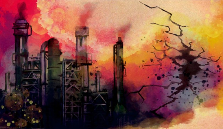
An illustration of a factory producing methane.
Guide to Investigating Methane — A Key to Fighting Climate Change (Short Version)
Read this article in

Resource Guide Chapter
Latest Tools to Help Reporters Investigate Methane Emissions
Resource Guide Chapter
Guide to Investigating Methane — A Key to Fighting Climate Change (Short Version)
Resource Guide Chapter
Climate Change Reporting Guide: Methane – Introduction / TOC

Resource Guide Chapter
Climate Change Reporting Guide: Methane — Interrogating the Data

Resource Guide Chapter
Climate Change Reporting Guide: Methane — Investigating Leaks and Emissions

Resource Guide Chapter
Climate Change Reporting Guide: Methane — Investigating Corporations — and Broken Promises

Resource Guide Chapter
Climate Change Reporting Guide: Methane — Holding Countries Accountable
Resource Guide Chapter
New Sources Emerge for Tracking Methane Emissions by Satellites
Resource Guide Chapter
Video: How to Investigate Methane Emissions


Journalism about methane sources is increasingly urgent.
Reducing methane emissions is the single fastest way to fight climate change, according to climate scientists. Emissions of methane, the second most abundant greenhouse gas (behind carbon dioxide), are rising rapidly and reaching new highs.
This summary of GIJN’s full guide to covering methane is designed to help investigative reporters identify specific sources of methane emissions and hold companies and countries accountable. We describe:
- The background on why methane emissions matter and the state of the current data sources.
- Why methane measurement systems are flawed and how to investigate them.
- How to find methane emitters on the ground and from the sky.
- How to question disclosures and commitments by companies.
- How to hold countries accountable for their emissions and pledges.
Here’s a condensed version of our tips and tools.
Interrogating the Data

Illustration: Marcelle Louw for GIJN
There is wide agreement among scientists that methane emissions are routinely undercounted or overlooked. This makes measurement itself an important subject for reporting.
There are several primary sources of information on methane emissions.
Overall methane emissions are tracked and published by the International Energy Agency (IEA), a Paris-based intergovernmental organization, most recently in Methane Tracker 2024. Country-by-country data is provided in the IEA’s Methane Tracker Database, which provides information on emissions and estimates of “abatement potential.”
Story ideas:
- What are your country’s emissions?
- Where do they come from?
- Are the measurements accurate?
National methane emissions data gets submitted to UN Climate Change by national governments, pursuant to the United Nations Framework Convention for Climate Change (UNFCCC).
The developed countries submit annual reports called National Inventory Reports (NIRs), about their greenhouse gas emissions. (See National Inventory Submissions 2021 on the UNFCCC site). Developing countries submit their emissions data as part of their Biennial Update Reports (BURs).
One critical weakness in methane emissions measurement occurs because each country is free to use different methodologies to make its estimates. This results in questionable data.
Another fundamental problem with methane emissions data collected by governments is that it is based on estimates and equations, not actual measurements. Some countries are legislating on this problem.
Investigating Methane Leaks

Illustration: Marcelle Louw for GIJN
The sources of methane emissions — particularly from natural gas and oil production — can be exposed.
Detection requires infrared cameras and satellites, meaning that collaboration with experts is necessary.
GIJN has identified two environmental groups with infrared cameras that are willing to work with reporters to conduct an on-the-ground investigation of possible methane emitters.
Story ideas:
- Work with groups or scientists who have infrared cameras that can detect leaks.
- Look to obtain satellite imagery from the growing number of sources.
The Clean Air Task Force (CATF) has documented emissions from oil and gas facilities all over Europe and is looking to expand to other regions. Here’s a YouTube description of the project and an explainer on its use of infrared (OGI) technology.
Journalists interested in working with a CATF camera operator should contact Rowan Emslie.
Another NGO with infrared camera capability and a willingness to collaborate with journalists is Earthworks. Reporters interested should reach out to Justin Wasser or Josh Eisenfeld.
Sources for Images of Methane Emissions
Satellite images can help journalists identify methane emissions from sources including petroleum extraction and transmission, coal mining, and landfills. Here are several sources of free satellite data.
Earth Surface Mineral Dust Source Investigation (EMIT) is a new resource from NASA, the US National Aeronautics and Space Administration. The portal “shows high-confidence research grade methane plumes from point source emitters – updated as they are identified.” Clicking on the red circles will show the time and concentration of the emissions.
Carbon Mapper is a US nonprofit entity whose data portal was launched in November of 2023. Zoom in on the world map, that is updated continuously as data becomes available. Looking ahead, an advanced imaging spectrometer will be on a satellite to be launched in 2024, which will add more precision to the measurements. Media contact: data@carbonmapper.org or Kelly Vaughn, kelly@carbonmapper.org
Methane Alert and Response System (MARS) from the UN Environment Programme (UNEP) posts a map and data showing methane emissions, mainly from sites related to oil and gas production, but also some from coal mines and landfills. The Methane Alert and Response System (MARS) began posting data in November, 2023, and adds new data twice a month. The data shows the country in which the emission occurred and gives the geographic coordinates of the source. Also provided among 17 columns is the rate of the emission in tons per hour. The database online is not sortable online, but can be downloaded in two formats, GeoJSON and CSV. However, public disclosure about the emissions occurs 45-75 days after detection because the UNEP effort combines transparency with engagement with emitters. Media contact: unep-newsdesk@un.org.
The Kayross Methane Map shows large emissions found by the French company Kayrros, dating back to 2019, with regular updates. Clicking one of the spots on the map (call up the “super-emitter view”) will provide descriptive information about the emission. Kayrros will work with reporters and answer questions. Media contact: team-kayrros@sonder-london.com
GHGSat Spectra reveals a selection of major emissions worldwide, although not with pinpoint accuracy and with a time delay of several weeks. (Sign up is required for access.) On the Spectra map, click in the upper right on the “Analytics From” box to change the dates of data shown. Click the triangles on the map to see details on each release. See “?” for more information. Spectra cautions: “Whilst we can see methane concentrations, it is not possible to use the map to identify specific sources of methane.” GHGSat is a company that sells more detailed information, hence its offers to “upgrade to SPECTRA Premium,” which a spokesman said, “would range from the tens to the hundreds of thousands of dollars depending on coverage and options selected.”
SRON shows methane emission plumes worldwide. It is produced by the Netherlands Institute for Space Research. The map is updated about every week and shows approximate source locations, but the resolution is low. A chart shows the locations by longitude and latitude (not the country). This presents a bit of a challenge, but putting the coordinates into Google Maps will show the location. Or try other coordinates converters.

The SRON project plots global methane plumes on a weekly basis. Image: Screenshot, SRON
SATALERT shows methane concentration levels, searchable by date. The map shows area-wide levels, not linked to specific sources. There is more background about how to use SATALERT, the creation of Australian researcher Dan Moss. By choosing different time periods, it’s possible to distinguish between intermittent high concentrations of methane, such as a large emission on one day, compared to a lower but steady concentration release. The images that SATALERT uses come from the EU’s Sentinel-5P satellites and have a resolution of 7.5-by-5 kilometers (4.65-by-3.1 miles) per pixel, which limits identification of specific facilities. However, to go deeper, SATALERT uses Sentinel 2 data for 20-meter resolution. Moss encourages reporters to contact him.
Climate Trace, a US nongovernmental organization, has a large inventory on the sources of greenhouse gas emissions around the world, including methane, with 395,075 sources identified.On the map, you can filter for methane, The latest data is from 2022, but it goes back as far as 2015 in some cases. Country total emissions are also available. The data is downloadable. It is based on estimates from a variety of sources (methodology). Contacts: Nikki Arnone nikki@inflectionpointagency.com or Fae Jencks fae@carthagegroup.com
GHGSat Spectra reveals a selection of major emissions worldwide, although not with pinpoint accuracy and with a time delay of several weeks. (Sign up is required for access.) On the Spectra map, click in the upper right on the “Analytics From” box to change the dates of data shown. Click the triangles on the map to see details on each release. See “?” for more information. Spectra cautions: “Whilst we can see methane concentrations, it is not possible to use the map to identify specific sources of methane.” GHGSat is a company that sells more detailed information, hence its offers to “upgrade to SPECTRA Premium,” which a spokesman said, “would range from the tens to the hundreds of thousands of dollars depending on coverage and options selected.”
The Global Methane Emitters Tracker (GMET), which came out in November of 2023, also provides a map and downloadable data, but does not primarily rely on satellite data. It is run by a US NGO, Global Energy Monitor. There are methane emissions estimates for coal mines, oil and gas reserves, and natural gas transmission pipelines. The data is downloadable and viewable with interactive mapping and aggregate summary tables. Tables provide emissions data by country. Media inquiries: David Hoffman david.hoffman@globalenergymonitor.org
WasteMAP identifies 4,056 specific landfills on a map and how much methane they are emitting. These estimates are based on public data from a variety of sources, modeling, and sometimes satellite images. WasteMAP researchers also calculated total country and city emissions. Media contact: wastemap@rmi.org
Chasing Methane from IndiaSpend is that country’s first methane tracker and monitors emissions in India across various sectors. Data gathered between January and September 2022 shows emissions from landfills in cities including Mumbai, Pune, and Bengaluru. The nongovernmental organization contracted with a private company to analyze data from EU satellites. The plan is to update the site monthly.
Also watch for scientific research on methane emissions. For example, this study describes “carbon bombs,” or potential fossil fuel resources whose use would result in substantial methane and carbon dioxide emissions. An environmental group, LINGO, extracted data from the study about what it similarly termed “methane bombs,” broken down by country.
Finally, there are commercial sources for emissions information based on satellite images. They sometimes provide information for free and offer discounts to journalists. Commercial providers include Geofinancial Analytics and Kayrros.
Kayrros recently released data on major emissions in 2023 to The Guardian, which did an extensive article: Revealed: 1,000 super-emitting methane leaks risk triggering climate tipping points. A Kayrros spokesperson said reporters could request the database, which has country-by-country information, and will be updated quarterly. Reporters also could ask for additional information about emissions in their countries.
Still on the Horizon
A new and much anticipated source is now expected to begin releasing data early in 2025.
MethaneSAT is a project sponsored by the Environmental Defense Fund and others, including Google. A satellite launched March 4, 2024, is orbiting the Earth 15 times a day at an altitude of over 350 miles. The satellite will measure methane levels with “unprecedented precision,” according to EDF and provide near-real time data. However, not for some time. “The satellite and data platform are expected to be fully operational and available to the public by January 2025,” according to EDF spokesperson Jon Coifman. (212) 616-1325 (office) (917) 575-1885 (mobile) Email
Other Places to Look
Images aren’t the only potential sources for information about emissions. Here are some other tips:
- look for public documents held by regulators,
- make friends with local scientists and NGOs working in this area, there is a lot of research going on, and
- talk with workers at oil and gas facilities and other potential emission sites.
Seeking comment from the sources of observed emissions is standard journalistic operating procedure, but the answers can be incomprehensible and intimidating.
Those responsible may say the emissions are legal or normal operating procedures. These statements may be correct and hard to verify. Turning to government regulators, both local and national, as well as knowledgeable NGOs is the best bet. Other potential sources are nearby residents, industry experts, plus employees, or former employees, of the company being investigated.
Investigating Corporate Emissions — and Broken Promises

Illustration: Marelle Louw for GIJN
Many companies are far from transparent about their methane emissions, but they are under increasing pressure to disclose more and emit less. The rising expectations should prompt journalists, including business journalists, to ask more questions.
The oil and gas industry, which is responsible for roughly one-third of methane emissions, is the most important sector on which to focus attention. Many, not all, companies report their emissions, and the way they report them can be tricky.
Story ideas:
- Focus attention on key industries.
- Ask about known or estimated levels of emissions.
- Ask about specific emissions goals and mitigation efforts.
The complexity of measurement forms a shield against inquiry, but not an impenetrable one. To penetrate it, it’s best to consult academic and NGO experts on climate change, and possibly corporate watchdogs and investors. And to ask companies for explanations.
Corporate disclosures about methane, where they exist, typically occur on company websites in “sustainability” reports. Some corporate disclosures, in a unified format, are available on the site of CDP, a not-for-profit organization.
One source of emissions is flaring during oil extraction. Flaring means the burning off of flammable gases, a process which produces mainly carbon dioxide, but also methane and other pollutants. Flaring is done for economic or safety reasons, and produces less methane emissions than does venting. The methane emissions result from combustion inefficiencies. Capturing the emissions for use can be done.
The World Bank’s Zero Routine Flaring initiative (ZRF) enlists governments and oil companies to publicly report their flaring. The flaring data self-reported by countries and corporations is published on the ZRF website.
A variety of efforts are underway to facilitate better corporate reporting about emissions reporting in the oil and gas sector.
The Oil and Gas Methane Partnership (OGMP) is an initiative with 74 large corporations as members, representing 30% of the world’s oil and gas production. Various UN agencies and the EDF are involved. The first report on the data was released in November 2021.
The Oil and Gas Climate Initiative (OGCI) is an industry initiative that created a Reporting Framework and publishes a useful library of resources. A consortium of some oil and gas companies created Methane Guiding Principles, which lays out best practices.
When it comes to reporting on corporate methane emissions, these questions are a good place to start:
- What are your methane emission levels?
- Are they rising or falling, and by how much?
- How are your figures calculated?
Verification regimes also exist, designed to certify that corporate operations are meeting standards. A legitimate line of questioning for companies is whether they will join such verification efforts. In addition, asking companies about their positions on proposed government policies relative to methane regulation may be revealing.
There has been a marked uptick in the number of corporations making promises to reduce methane emissions. The details of their commitments, however, may not be so clear, and the adequacy of their pledges is a matter of much debate.
Look for information on the specifics and mechanisms of commitments. Some suggestions include:
- Because stated reduction goals are often for extended periods, like 10 or 20 years, ask about short-term and intermediate goals.
- Inquire about how, exactly, the plan will be implemented, which is not always spelled out.
- Look into the methods for achieving reductions.
Picking the largest methane emitters as initial targets makes sense. An especially promising focus would be the large nationally owned petroleum companies.
Methane emissions don’t just occur at the extraction point. Attention is increasingly being focused on emissions all along the supply chain.
Methane emissions derive from agriculture, aviation, maritime shipping, and other sectors.

Illustration: Marcelle Louw for GIJN
Agricultural production, in particular, is a significant source of methane, mainly from rice growing (released by bacteria in flooded paddies) and cattle farming. Questions are being raised not only at the farm level, but also of the companies that use the raw materials, about what mitigation can be accomplished.
Following the latest research on solutions is a necessary supplement to reporting on methane. New ideas are being tested at a rapid pace. Following the science will potentially yield timely questions to pose.
Holding Countries Accountable for Methane Emissions
In advance of the UN climate change summit (COP26) in Glasgow, Scotland in November 2021, many countries made promises to reduce their methane emissions.
Story ideas:
- How and why were national reduction levels chosen?
- How will the goals be accomplished and verified?
Information on similar emissions commitments can be found in the UN’s Nationally Determined Contribution (NDCs) reports submitted by individual national governments. The NDCs are published on the UN’s NDC Registry. The UNFCCC also prepares NDC synthesis reports. (See the October 2021 version here.)
Some countries disclose national emissions data in these reports.
As of early 2024, 156 countries had signed the Global Methane Pledge to contribute to a collective effort to reduce overall global methane emissions by at least 30 percent from 2020 levels by 2030. There are few signs of progress so far, according to a Kayrros analysis in late 2023. Member countries are not obligated to set specific targets for themselves. For individual government promises, reporters will need to do national reporting. However, many countries have made announcements. See a critical report by the Environmental Investigation Agency and in The Washington Post.
The best sources for critiques of the plans will likely be local/regional environmental groups, scientists, the business community, and political actors.
Because the measurement of the emissions is a critical starting point, reporters could scrutinize the methodology being used to estimate the emissions.
Sub-national jurisdictions, such as provinces and cities, also are making net-zero commitments.
“There is no question that methane gas emissions are a huge problem, accelerating climate change at a critical moment for our planet,” said Rafael Lorente, a former reporter who is currently director of the University of Maryland’s graduate school of journalism. “The journalists’ problem is telling that story in a compelling way.”
Additional Resources
Climate Change: GIJN’s Guide to Investigating Methane (full guide)
New Data Tools and Tips for Investigating Climate Change
Investigating Environmental Crimes and Climate Change
 Toby McIntosh is GIJN’s Resource Center senior advisor. He was with Bloomberg BNA in Washington for 39 years. He is the former editor of FreedomInfo.org (2010-2017), where he wrote about FOI policies worldwide, and serves on the steering committee of FOIANet, an international network of FOI advocates.

This work is licensed under a Creative Commons Attribution-NoDerivatives 4.0 International License
Republish our articles for free, online or in print, under a Creative Commons license.
Republish this article
This work is licensed under a Creative Commons Attribution-NoDerivatives 4.0 International License
Read Next

Reporting Tools & Tips
Tips for Choosing Climate Stories that Make an Impact
Given widespread misinformation and climate skepticism, veteran environmental reporters offer case studies and best practices for pursuing impactful topics of climate investigations.
Reporting Tools & Tips
Tips to Investigate Climate Change Impacts in an Era of Science Denialism
As oligarchs and populist governments ratchet back the gathering and dissemination of climate-related information, journalists can use these techniques to find relevant sources and track impact.

Data Journalism Reporting Tools & Tips
NASA’s Worldview Site Expands Data and Environmental Reporter’s Toolbox
NASA’s Worldview database is a valuable tool that journalists can use to find data and free graphics on a range of topics, like wildfires, floods, deforestation, and many more.

Climate Reporting Tools & Tips
Fossil Fuel Investigations: How to Find Stories Using Oil and Gas Supply Chains
The oil and gas industry is complex and notoriously opaque. But with new tools, it’s become easier for investigators to dig into this field.