Data Journalism Data Journalism Top 10
Data Journalism Top 10: UK Housing Affordability, Russian Casualty Count, US Book Bans, and Redefining Poverty
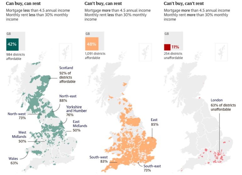
In this week’s Top 10 in Data Journalism, GIJN looks at the perilous state of UK housing affordability, tabulating a true Russia casualty count, and the common traits among US banned books.