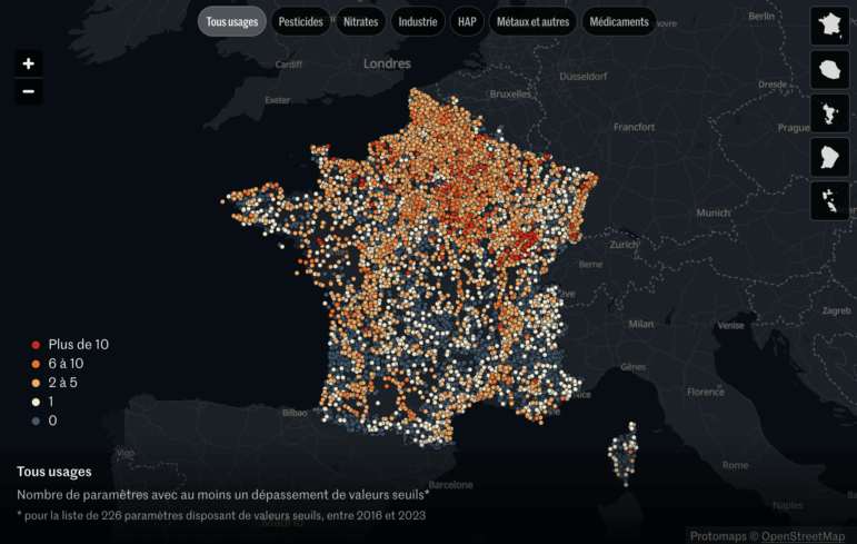
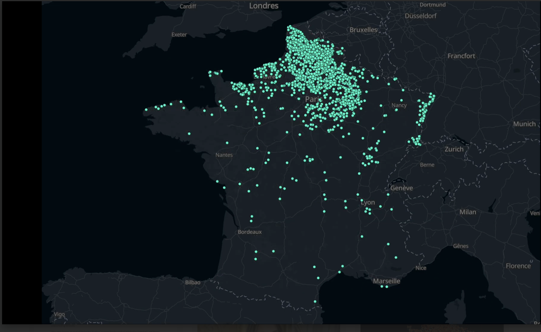
Le Monde's interactive map of France's groundwater quality shows total usage along with the presence of various chemicals, classified by their use. Image: Screenshot, Le Monde
How a Le Monde Team Uncovered 300 Contaminants in France’s Groundwater
Read this article in


Atrazine desethyl. Chlorothalonil-R471811. Perchlorates. These names may be unfamiliar; when we started our investigation, we barely knew them, either. Yet they are among 300 pollutants that can be found in nearly all of France’s monitored groundwater — the source of drinking water for two-thirds of the population.
In more than 28% of water sampling stations in France’s groundwater monitoring network, their presence exceeded legal quality limits at least once over the last eight years.
Water scarcity is also a pressing challenge. France is experiencing increasingly frequent droughts, and competing demands for dwindling water supplies — between cities, farmers, and industry — are exacerbating tensions.
This investigation began as part of Under the Surface, a cross-border project examining the deterioration of European groundwater, initiated by Datadista and Arena for Journalism in Europe and supported by JournalismFund Europe. While reporting on the Spanish groundwater crisis, reporters Antonio Delgado and Ana Tudela had found a way to access European member states’ latest reports on the status of their water bodies — which they have to send to the EU Parliament and Commission every six years.
Arena for Journalism in Europe suggested expanding the effort to other countries and contacted me to work on the French situation. I joined forces with my colleagues Léa Sanchez, who worked with me on the data analysis and reporting, and Elsa Delmas, with whom I partnered for the cartography and web development. We also received a lot of help from the web design department, especially from designers Léa Girardot and Thomas Steffen.
Digging into the Data
Initial European data revealed a troubling picture: France’s groundwater bodies were in poor health, particularly in terms of quality. We wanted to know why. Which contaminants were responsible? Who produced them? Was it possible to tell our readers the pollution levels in their groundwater?
Thanks to the European reports, we knew that France had been able to compile a lot of data. Ades, the French national groundwater data portal, enabled us to access results from every measurement at every station. But “open data” came with caveats. At the time, the Application Programming Interface (API) couldn’t handle very ambitious requests. The interface’s hard-to-find export button didn’t allow us to download data for the entire country at once, so we extracted data region by region — exporting millions of records and storing them on our own server.
But this was just the beginning of the challenge. The chemical names were cryptic, and the number of measurements overwhelming. We turned to expert-reviewed journalism, collaborating closely with scientists, to make sense of this information.
Hydrogeologist Florence Habets, a research director at the French National Center for Scientific Research (CNRS), kindly agreed to advise us from the start.
“You should look at atrazine,” she told us. “This herbicide has been banned for years, but it still turns up in sampling.” She was right: this substance, and especially its metabolites — byproducts of the active substance — exceeded one microgram per liter in approximately 1,700 of the monitoring stations (7% of the points where they were tested).
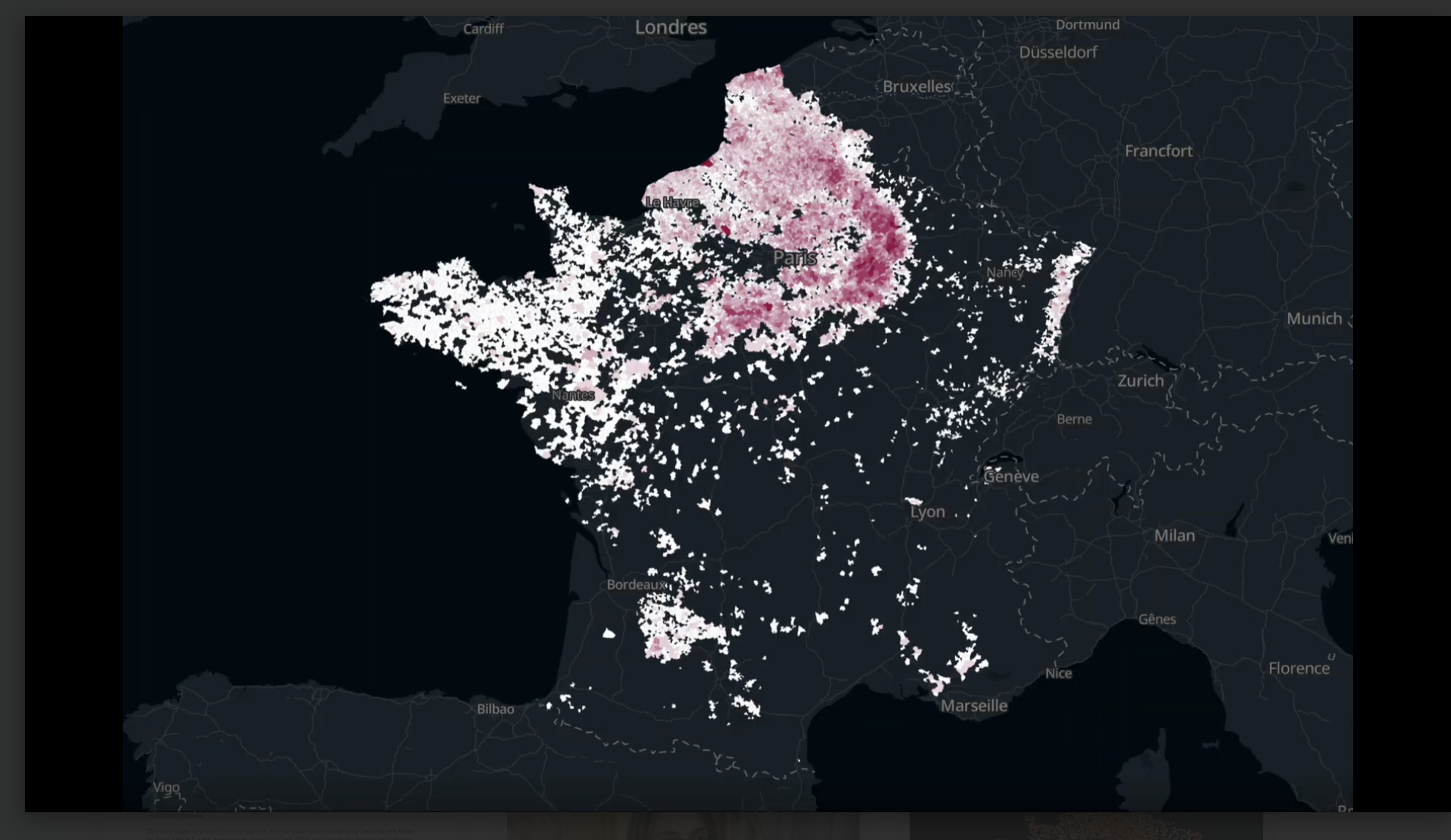
Maps from the investigation showing the areas of beetroot production in France (top) and their findings of the herbicide chloridazone (bottom), approved by the EU for controlling weeds in crops. Images: Courtesy of Raphaëlle Aubert, Le Monde
Narrowing Down the List
To decide which pollutants to track, we followed the French geological survey’s (BRGM) groundwater assessment guidelines. BRGM’s Laurence Gourcy, a hydrogeologist, guided us through data and methodological interpretations. We removed 25 substances — such as naturally occurring elements like iron, manganese, or substances linked to water treatment — from this list, which left 226 contaminants.
To know whether measurements were concerning or not, official norms were the best source of information. We collected all the environmental quality standards we could find in the EU and in France, especially the 2008 and 2023 administrative acts. This way, we could tell whether a concentration that may sound negligible, such as 0.1 microgram of a substance for every liter of water, was considered legally too high. The answer is yes — for many pollutants such as pesticides.
However, a lot of pollutants we could find in the data were not regulated at all in groundwater. We added 74 of these compounds, which are under special surveillance by the authorities, to our list. They include bisphenol A — used for producing plastics and epoxy resins, some PFAS, or “forever chemicals” — to which I was attentive, having investigated this major pollution crisis before — and pharmaceuticals. Although no official thresholds exist, finding traces of medications such as antiepileptics, painkillers, or birth control pills in our groundwater revealed how vulnerable it is.
Our overall list had 300 contaminants. To make them more comprehensible, scientists were once again of great help: Florence Habets advised us to group them by usage. We created six categories:
- Pesticides and their metabolites, from agriculture
- Nitrates, nitrites, and other nitrogen fertilizers
- Industrial chemicals used or produced in manufacturing
- Polycyclic aromatic hydrocarbons (PAHs), originating from the incomplete combustion of wood or other organic materials
- Metals, metalloids, and other minerals
- Pharmaceuticals
To filter and analyze the data, we wrote a Python script using Pandas — an open source library designed for data analysis. Processing gigabytes took hours; we would often launch the script at night. But the findings were stark:
- 28% of a network of over 24,700 monitoring stations showed at least one exceedance
- Some stations exceeded thresholds for 10, 20, or even more than 30 substances
- Pesticides and their metabolites were detected in 99% of monitoring points.
Empty spots on the map didn’t necessarily mean clean water: the main drive for groundwater testing is the ability to pump this water to make it drinkable; some wells had been abandoned because they were too polluted already, so they were no longer tested.
On quantitative water issues, we drew on the expertise of the International Groundwater Resources Assessment Center (IGRAC). Their hydrogeologists and data scientists had already developed a method to calculate the trends in groundwater levels. Thanks to their support, we were able to concentrate our efforts on pollution data.
Many other scientists, with skills ranging from public health to biogeochemistry and to geographic information systems, agreed to help us or to review our work. Creating a trustworthy relationship with them was key to the success of our investigation.
Making the Invisible Visible
Numbers alone felt too abstract. To bring them to life, we looked for testimonies from affected communities. In Chartres, southwest of Paris, local officials are grappling with contamination and agricultural needs that affect municipal supplies. Many municipalities faced with frequent pollution are investing in treatments, increasing the price of potable water for their constituents.
We also wanted readers to visualize the extent of the problem. Our maps became the centerpiece of the investigation, and I would strongly encourage any reporter willing to replicate our methodology to display their results on an interactive map. We superimposed our findings with other spatial datasets, such as beetroot production (computed from the French “registre parcellaire graphique”), associated with a specific herbicide called chloridazone.
A tool worth highlighting is Protomaps, an open source solution based on OpenStreetMap, which allows journalists and developers to serve customizable tiled maps. In 2022-2023, I set it up for our newsroom as an open source alternative to expensive proprietary basemaps. Used with MapLibre and DeckGL, Protomaps has enabled us to create a wide variety of visuals, from standalone interactive cartographies to scroll-animated maps. Thanks to this tool and her development skills, Elsa Delmas transformed our datasets and map prototypes into a striking “scrolltytelling” article. We also included “explore the map” buttons to allow the most curious readers to take a break from their reading and zoom in on any data point.
After publishing our piece, we released our datasets as open data. Our methodology is also publicly available. If you can access data or test groundwater samples in your region, you can replicate this investigation.
 Raphaëlle Aubert is an award-winning journalist at Le Monde. She covers the news through data, leading collaborative investigations with scientists and fellow reporters to track (hu)man-driven pressures on the environment. She developed the Forever Pollution Project’s map of PFAS contamination in Europe, published in 2023, and led the evaluation of the staggering cost of PFAS decontamination two years later. In 2025, her piece 300 Contaminants in our Groundwater published in Le Monde with Léa Sanchez and Elsa Delmas as part of the Under the Surface cross-border investigation, received a Sigma Award for best data-driven project. She can be reached at aubert@lemonde.fr.

This work is licensed under a Creative Commons Attribution-NoDerivatives 4.0 International License
Republish our articles for free, online or in print, under a Creative Commons license.
Republish this article
This work is licensed under a Creative Commons Attribution-NoDerivatives 4.0 International License
Read Next
How They Did It
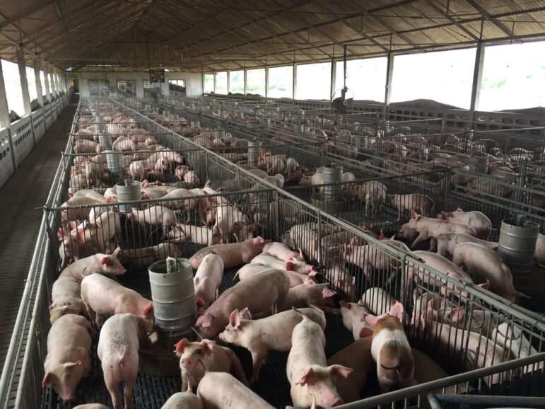
Uncovering the Hidden Environmental Impact of an Industrial-scale Hog Farm
An award-winning project exposed how a US-governor’s pig farming company polluted groundwater, revealing issues of political influence and regulatory neglect.

10 Questions
Exposing Industrial Pollution and Creating the ‘Forever Chemicals’ Beat
In a career spanning more than 20 years, Le Monde reporter Stéphane Horel has brought a creative and, at times, humorous approach to groundbreaking environmental investigations.
How They Did It
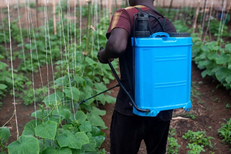
Investigating How Pesticides Banned in the EU Find Their Way to African Countries
GIJN speaks to a Nigerian journalist about how she uncovered how banned pesticides are still exported and sold in Africa.
Data Journalism Methodology
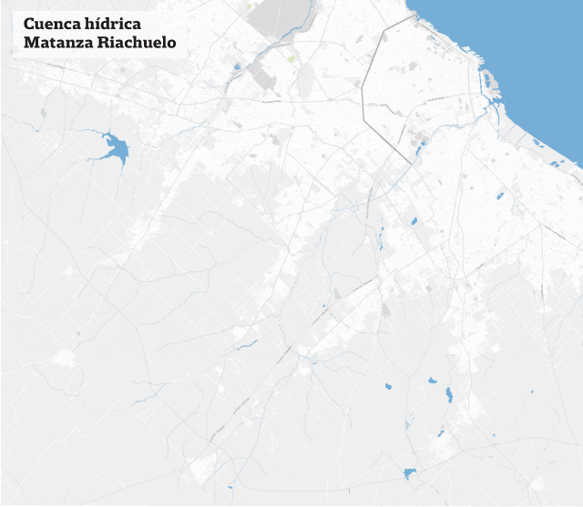
La Nación Maps Pollution on Argentina’s Matanza River
There is a huge amount of data available on pollution and disease caused by the Matanza River – widely known as River Riachuelo – the problem was transforming it into information that those affected could easily understand. In a special multimedia report, La Nación used open data and data visualization to illustrate the extent of the problem.